 As I wrote in this weblog I went to Mt. Takane which is highest mountain in Shimoda yesterday.
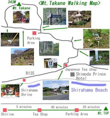
Then I remember that I was going to make a webpage of Mt. Takane hiking with a guide map.
So I decided to make it today, but I could make only map like this.
Because I wanted to make not only simple map but also map with pictures.
It took long time, so I couldn’t make all webpage today.
The route to the top of Mt. Takane is not difficult, so if you would like to go there please use this map.
